LiDAR LiVE Info
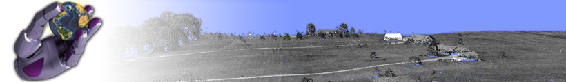
LiDAR LiVE is an interactive software tool that allows full processing and analysis of data collected by LiDAR technology (Light Detection And Ranging). LiDAR technology allows fast capturing of spatial data of a large geographical area with high accuracy and resolution. As a result, lots of points obtained, therefore optimization techniques are needed for their real-time visualization. So, we are able to render several millions of points in real-time with high quality on computer systems with lower graphic power. Such visualization provides high system responsiveness, and presents a framework that allows processing of LiDAR data.
You can download it and try it out for free.
You may also contact us with any feedback or suggestions by writing to us.
LiDAR LiVE is one of the algorithms, developed in Laboratory for Geometric Modeling and Multimedia Algorithms at Faculty of electrical engineering & Computer science, University of Maribor, Slovenia.
Please inform us about your experiences with the LiDAR LiVE through the e-mail. All comments are highly appreciated